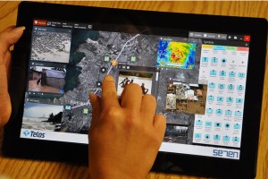
Cloud infrastructure will allow response organizations from all over the world to collaborate quickly and effectively to deliver a better disaster response, proponents say.

An industry and government team came together Sept. 12 to demonstrate how cloud computing could improve response time, collaboration and mission success for international disaster relief.
The Network Centric Operations Industry Consortium (NCOIC) led the demonstration for the National Geospatial-Intelligence Agency (NGA) live in McLean, VA, and via webcast, with a simulation based on the 2010 Haitian earthquake. The simulation showed how a federated cloud infrastructure can be quickly activated and how response organizations from all over the world—all using different technologies and applications—can supply and retrieve critical information.
The Geospatial Community Cloud (GCC) project began in the fall of 2012 with the design of the cloud infrastructure and the addressing of a range of issues including ownership, bandwidth, latency, availability, access, flexibility and security. The portal was then leveraged to integrate applications supplied by other NCOIC members into the disaster management.
The interoperable cloud environment provides the capability to collaborate with international partners and share non-classified information, while maintaining security and protecting access to sensitive data, according to David Bottom, director of NGA Information Technology Services. “This technology can help us to deliver humanitarian assistance and save lives around the world.”
The Case for the Cloud
Fire Chief Ernie Rhodes of St. Louis County, MO spoke during the event about how the technology relates to public safety on a smaller scale right at home, and improves on current disaster response procedures. “We’re relying on these big thick manuals that we only look at once a year because we have to,” he says. He calls today’s process ineffective at the edge of chaos, and too cumbersome with its forms and checklists.
“We have an opportunity to make it better,” he says.
His approach is to provide a simple and reliable system that allows an expert to walk local leaders—who don’t see disasters every day—through their emergency. “How you get these folks to stick to the concepts is by having a network to go through the process with them,” he says; for example, being able to tell them, “Ok, you had a tornado. Now you’re going to have a fire and run out of water, so here’s what to get in place now.” Otherwise, it’s typical for agencies to get caught up in a reactive response mode and let the event drive them. “We need to stop that,” Rhodes says.
Creating a Cloud Disaster Management App
“Most people have their plan on a shelf… they need an app,” Rhodes says. That’s what’s going to bring expert assistance to the scene instantly at 3 a.m.
He and colleague Colleen Dealey of Cloud Bound, LLC demonstrated a cloud application they created and its disaster-management capabilities. The features include:
- A guide with response templates
- Training mode and live mode
- A repository to share resources
- Connection to subject matter experts 24/7
- Ability to allow remote observation to authorized outside entities
Functions of the app include messaging; tracking resource requests and status; tracking what has been assigned and still needs to be assigned; mapping; managing finances; and viewing social media exchanges about the incident.
The Disaster Response Demonstration
The NCOIC project team built the Geospatial Community Cloud (GCC) infrastructure earlier this year. A three-month test phase led up to the Sept. 12 demonstration in which the members also served as actors. The Aerospace Corporation, Boeing,NJVC, Raytheon Company, Telos Corporation and Winthrop Management Services provided technical services and applications for responders in the field and for mission managers thousands of miles away.
“This Geospatial Community Cloud project shows that precious time and money are saved when you can quickly and efficiently access a cloud infrastructure instead of waiting for an onsite IT hosting environment to be established,” said Tip Slater, NCOIC director of business development, in a prepared statement. “In dramatic fashion, the project also underscores the need for interoperability to enable different systems and users to communicate across borders and boundaries.”
According to the NCOIC, as each responder organization is able to easily and rapidly plug into the cloud to retrieve and share data, individual applications become more powerful and mission work becomes more effective.
Based on the successful demonstration, the NCOIC announced that a new, open process, known as NRRC (NCOIC Rapid Response Capability), will be made available to international, federal, state and local governments as well as non-governmental organizations and businesses that need to build a federated cloud environment. “NRRC will include checklists, rules and patterns designed to help these organizations achieve interoperability so they can act quickly and succeed at their work, while minimizing technical risk, saving time, reducing cost and ensuring reliability,” the consortium states.
“When you can plug your everyday application into a cloud, it becomes more robust—for you, the users you collaborate with, and the others they interact with,” says Slater. “Interoperability is an important consideration for the developers who build applications, the customers who buy applications and the users who rely on applications to get their jobs done.”
This article originally appeared at EMSWorld.com on Oct. 17, 2013.
